Showing posts with label Weekly Walk. Show all posts

Monday, 23 September 2013

How to Escape Your Four Walls and Socialise; Weekly Walk #26

I’ve got a few friends who, no matter how much time has passed since our last meeting, relax into an adjacent sofa and say just the right thing to make me smile. Substitute the sofa for a pair of hiking boots, and that’s exactly what it’s like to walk with the Hampshire 20s and 30s walking group. Read on to hear about our adventure and details on how to join.

This week, Mark took us on a walk skirting the edges of five villages from East Tytherley in West Hampshire, giving us a break from our day jobs to catch up about our summers (I even found out that Mark likes making music like me) and welcome new-comers into our friendly banter. I left feeling energised by an afternoon of fresh-air and like-minded conversation.

We met at 10.30 at the Star Inn and walked mostly through open fields, patches of woodland, and down a few country lanes. It was warm and I did the whole thing in my T-shirt, but made sure I bought my trusty pack for water, snacks, and just in-case waterproofs.

There were lots of refreshments on offer. We stopped at Annie’s Tea Room in Kimbridge and I had a delicious hot chocolate with marshmallows and cream. There was even a lovely farm shop where I bought a bottle of Quiver by Bowman, one of my favourite local beers.

It wouldn’t be a walk without a hair-raising trek across a field of cows after reading the dreaded sign, “Beware of Bull.” It didn’t help that my jacket is bright red. Testing the myth, I trekked across as the cows stiffly eye-balled us and mooed their warning moo. It was exciting, though the young couple passing after us didn’t seem amused by our warning jest.

Back at the Star Inn, I ordered a plate of delicious cheese and bacon potato skins and enjoyed the conversation outside with the group, fussing over the local dog and cat. For a writer stuck at his computer most days, this walk was a much needed break and adventure.

If you fancy trying a similar walk, a route can easily be mapped out using the OS Explorer 131, Romsey, Andover & Test Valley. The large car park at the Star Inn made a great starting point, and don’t forget to check out Annie’s Tea Room or even the abbey at Mottisfont.

If you’re an outdoorsy type looking for a weekend escape from your day job, then click here to find out how to join the Hampshire 20s and 30s walking group or here to view the Ramblers website and find a similar group in your area.


Tuesday, 17 September 2013

A Shortcut to Blackberries; Weekly Walk #25

I love this time of year. Not only is the weather that much cooler (perfect for hiking), but little buds of blackberry sweetness are springing up all over the place. I collected a whole load the other day and made a fantastic apple and blackberry pie. I find more this week on a walk in Wiltshire, stopping at Ludgershall Castle and exploring near-by Collingbourne wood.

I squeezed my car into the little castle car-park, where a lady walking her dog commented on the lovely weather (how British!). I meandered through a trench of thick brambles to a semi-circular hill, which was similar to most hill-forts and Avebury stone circle. The castle was, well, a ruin, but a nice spot to enjoy a coffee at the end of a walk.


I took a farm track on the east of the castle and turned left onto a footpath. After several photos of the landscape with my low-quality point and shoot camera (which didn't turn out too bad with the help of pixlr.com) I followed a bridleway round the left of the woods. Drawn into the magical woodland, I sat to drink my coffee, when a great big dog came growling round the corner. I thought it funny when his owner said I'd startled him. I continued diagonally across a field and north-east to a byway.


I decided against the shorter route and turned left down the hill, passing thick bushes of blackberries, tempting me to stock-up for a second pie. At the bottom of the hill I turned left and walked the base of a valley. It was secluded with horses above, and I felt like I was in a Western, and that any minute a load of gun-toting baddies were going to sabotage me.


Now almost at the most northerly edge of the woods, I turned right up a hill and right again onto a woodland path. I was now in the heart of woodland. It was very quiet and I only passed one jogger on the thirty minute section. I went too far, but was easily able to reconnect with the path back towards Ludgershall and finally emerged by some farm houses and headed back to my car.


This was a relatively easy walk with no getting lost and the sighting of a buzzard (not to mention lots of rustling animals in the woods that I couldn't identify...) Not a bad start back into weekly walks after my summer break. Next week I’ll report on a walk with the Hampshire 20s and 30s walking group in Lockerley, then I’ll be down Bournemouth way for some urban walking.

Right, off to enjoy some pie.

Monday, 22 July 2013

Lost in the Woods; Weekly Walk #24 Without A Map

Don’t you just love moving house. Everything is in boxes, you can’t find pots to cook with, and all of your carefully organised maps have vanished. This week, I wasn’t going to let that stop me. I set out blind to Bentley Wood, an area I knew relatively well but had yet to find a circular walk of, and using crude maps and what little sense of direction I had, attempted to get back to my car in one piece…

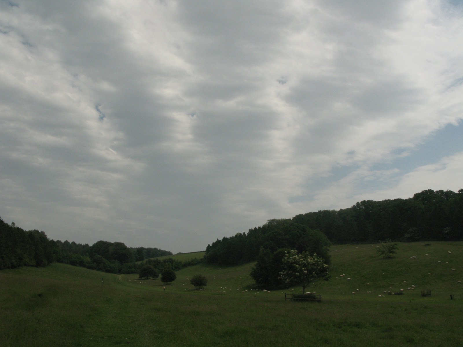
I switched down to first gear as I trundled the uneven, pot-hole ridden woodland track to the car-park, which even at 8.30am was starting to get full. I took the above photo for the blog, and set-off down a long track through the heart of the woods. I’ve seen lots of animals here before, including a heard of deer, and a swooping owl, but today I saw birds and butterflies.


I wasn’t sure if I was still on the main track, as I knew from maps that I’d seen before that it should continue straight, yet the woods were clearly behind me as I strode along a field edge into a second area of woodland. I was about to turn around, when I found a crude map with a red arrow to tell me where I was, and using the photo I’d taken earlier, was able to cross-check and confirm where I was.


I decided to turn down a smaller track and followed it past a few horse riders. I wanted to stay aware of where I was so I could turn around if need be, but when I reached the end of the track, I turned left into thick woodland and tried to navigate myself back around in a loop to where I’d come from. The crude map wasn’t much help as I kept coming across paths that weren’t shown, and each time I past one I had to remember the route back. “Straight over cross-roads, left at the big tree, follow it round to the main track.” It was a little scary, yet had my adrenaline going; a true adventure!


I saw a clearing through thick trees, and ventured off the path to have a look. I was overlooking the field I’d passed earlier, and knew that if I kept going left I would eventually find the path. I set-off, and after a few moments of wondering if I could even remember the route if I had to turn around, I was back at a familiar bench with a dried banana skin (a unique thing to help me remember!).


Most people would be content with having completed a small circuit and be heading back on the path that they knew for sure led back to their car, but not me. I came across a path on the left that my crude map (which I was checking on my camera) indicated would, after a few twists and turns, lead me back. I followed it into true woodland, where nothing but a small slip of light peeked through the still leaves. I hit a road, so turned around and found the footpath I was looking for; a narrow path through thicker woods. I knelt down to get some shots of the moss and a few close-ups, confident I was heading the right way.


Until my straight path became a cross-roads, and I had to guess, taking a path that hit one of the main tracks sooner than I would’ve imagined. I figured I must have gone wrong, and had no way of telling for sure which part of the woods I was in. I made a guess and followed a route, which luckily led me back to an area I recognised, but I could just have easily have taken the wrong path

I took a  small track into Geoff’s Copse and found a bench with a stone monument set behind it in a clearing of grass, both dedicated to Geoff Parfitt, a forester and countryman.  It was quite magical, with butterflies dotted around it; if a sword had been poking out of it I would’ve have accepted I was in a fairy-tale. I continued, stopping to take a few photos of the butterflies, when I saw the edge of a car-park and hoped it was where I had parked.


When I caught sight of my car, I realised what a different walk this had been. Of course, it’s a good idea to have a map and know your route, especially when walking on your own, but perhaps in small, enclosed spaces, it’s okay to rely on more basic maps and crude navigation. It certainly adds to the fun, allowing you to make random discoveries, which is very satisfying when you reach the end.

Bentley Wood is located between the villages of Pitton and Farley, Wiltshire, with the car park I used today off Scout's Lane, 51.060993, -1.633190.

You can read more about upcoming events in Bentley Wood on the Pitton and Farley website.


Sunday, 30 June 2013

The New Forest and the Bouncing Bomb; Weekly Walk #22

I’ve always lived near military establishments, from camps near Farnborough, to the airbase in Middle Wallop, and then today, as I took a hike through the New Forest, I discovered I’m near the test site of the famous Dam-Buster bouncing bomb. This week I enjoy sun, picturesque views, and cooling woodland as I skirt the edge of the Ashley Walk bombing range on a hunt for WWII history.

I grabbed the last space at the Telegraph Hill car-park, on the junction of the B3078 and B3080, a few miles outside of Downton, Salisbury. It was a typical New Forest scene; a small yet busy roadside spot for hikers to gather before taking various trails and adventures. I picked up my Crimson Short Walks guide, and took a left out of the car-park onto the road and left along a wide gravel track.


Along with the sweltering sun, the open heathland reminded me a lot of the desert in New Mexico, through with the addition of New Forest ponies. I loved it when the sound of the traffic faded away and left me with miles of quiet, blissful wilderness, though it wouldn’t have always been like this.

In the mid-1940s, the Ashley Walk bombing range housed several bunkers and walls for testing bombs and methods of delivery. Dr Barnes Wallis’ bouncing bombs were tested on the No 3 wall, including the initial Highball bomb and the later “Upkeep” bomb used in the famous Dam Raids. The range is now empty, save a few craters and a small brick hut which might have been a viewing post. I later researched and found a great video from the Imperial War Museum; a succession of tests from 1943 of the Highball bomb.


I turned left and followed a way marked cycle track through the managed, man-made woodland of Amberwood and Islands Thorns Inclosures. I stopped by a stream to have my lunch, and enjoyed the peace and quiet, before continuing the winding path out of woodland to Fritham village green. Here, I passed a late-19th century post-box created to save the postman, who delivered and collected mail to and from the nearby Schultze Gunpowder Factory at the bottom of the hill, a ½ mile round trip.


I continued down the hill and came upon Eyeworth Pond, which was serene, and might have made a better picnic stop. I crossed a bridge and followed a track past Oaktree Cottage into a dense wood. I stopped to take pictures of some Fox-gloves, before following the winding path back to heathland. I got turned around and thought I was walking the wrong track, but after doubling back I realised I was headed the right way, and at a junction of paths turned left downhill, then back up towards my car.


You can read more about the Number 3 wall and Highball bomb testing on the New Forest Remembers website, a site dedicated to the New Forest’s importance in WWII.

The New Forest Explorers Guide also has some great information on the Ashley Walk bombing range.


This walk was from Crimson Short Walks, the New Forest National Park guide (number 19, Around the Islands). It’s a great guide with clearly detailed OS maps for each walk. Check it out on Amazon.

Thursday, 20 June 2013

Grand National Champions and a Pair of Sore Shins; Weekly Walk #21

Desperate for a well-worn, scenic walk after my recent overgrown, confusing trail from Pepperbox Hill, and in need of a longer walk than last week before work, I turned to my Hampshire and New Forest guide for a walk from nearby Rockbourne, Fordingbridge. I discovered a famous training stable at Whitsbury Manor and didn’t get lost, which was a plus, although I still had to wade a nettle-ridden path in my shorts (and hide the pain of throbbing legs all night).

Once in the village, I parked on the road as the hall and its car-park were in use, and met a fellow walker who'd just enjoyed a similar route. I set-off confidently along the track past a farm and followed a local as he bounded his way past sheep under the blissful sun of the open field. I could've easily cracked a cider and had a picnic, but instead continued my way through gates to a cool, tree-lined path.


I walked past a stud before crossing the road to Whitsbury Manor Stables, which are famous for training Grand National champion horses Red Rum and Rhyme‘n’Reason. I’m not a big fan of horse racing, but there was a definite air of professionalism and respect as I skirted the grounds. I continued a path overlooking fields and descended to the bottom of the valley.


I turned right onto a wide track and walked quite a distance past two farms, before turning right again through a gate and heading uphill. I was planning on taking lunch a little further up, but the sun took its toll and forced me to take a breather. Once refuelled, I continued uphill before entering woodland and taking a sharp left down a muddy, forest path.


I emerged from woodland near another farm, turned left down a country lane and right into a field. At the end of the field I found what was meant to be a narrow path, but was little more than a jungle. A pair of walkers and their dog met me halfway; their arms raised high as they waded through thick bushes where the path should’ve been.  “How sensible,” I commented, as I looked between their trousers and my now red-raw, bare shins.


Finally, the path (and the pain) ended at a stile on the left into an open field with horses, which led me back to Rockbourne and my car. All in all, this had been exactly what I wanted from a walk; a good six miles, scenic and straightforward to follow, though it's seems I'm currently doomed to take on overgrown paths, but I suppose they only add to the adventure.


This walk was taken from the Hampshire and New Forest Walks pathfinder guide.

Click the link to read more about Whitsbury Manor Stables on the website for Marcus Tregoning Racing.